
Pir Chinasi hiking tracks
Pir Chinasi hiking tracks
Pir Chinasi hiking tracks
About
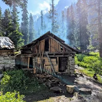
The Pir Chinasi hiking tracks are situated approximately 30 kilometers east of Muzaffarabad in the Azad Jammu & Kashmir region, positioned at an elevation of around 2900 meters (equivalent to nearly three km). This out-and-back trail spans a distance of six kilometres and offers easy hiking with minimal difficulty. The terrain features lush mountainous landscapes that lead trekkers on scenic routes, providing dramatic panoramic views over the Jhelum Valley as well as snowy peaks in the horizon.
Frequently Asked Questions
When is the best time to visit Pir Chinasi hiking tracks?
The best time to visit is during March, April, May, September, October and November. These months offer the most favorable conditions for visitors.
What is the elevation of Pir Chinasi hiking tracks?
Pir Chinasi hiking tracks is located at an elevation of approximately 2,900 meters (2.9 km) above sea level.
How difficult is the trek to Pir Chinasi hiking tracks?
The difficulty level of Pir Chinasi hiking tracks is rated as Easy — suitable for beginners and families with basic fitness.
Do I need a guide for Pir Chinasi hiking tracks?
No, a guide is not required for Pir Chinasi hiking tracks. However, a local guide can still enhance your experience.
Is Pir Chinasi hiking tracks family-friendly?
Yes, Pir Chinasi hiking tracks is family-friendly and suitable for visitors of all ages.
How long does it take to explore Pir Chinasi hiking tracks?
It takes approximately 2.5 hours to explore Pir Chinasi hiking tracks. Plan accordingly.
How long is the trail at Pir Chinasi hiking tracks?
The trail at Pir Chinasi hiking tracks is approximately 6 km long.
What type of trail is Pir Chinasi hiking tracks?
The trail at Pir Chinasi hiking tracks is a out-and-back route.
What is the elevation gain at Pir Chinasi hiking tracks?
The total elevation gain is approximately 400 meters.
Are the Pir Chinasi hiking tracks clearly marked for tourists?
The main routes toward the shrine are well-trodden, but the extended tracks toward Pir Asmar are less defined and lack consistent signage. It is highly recommended to use a GPS-based mapping tool or hire a local who knows the specific ridgeline shortcuts.
What footwear is appropriate for the terrain at Pir Chinasi?
Sturdy, waterproof hiking boots are necessary, especially if you plan to explore the ridges where the terrain is a mix of loose gravel and dense forest floor. The weather can change rapidly, and moisture on the pine needles can make the slopes surprisingly slippery.
Is there access to water along the trek to Pir Asmar?
There are no established water points along the 4-hour trek from the main hill station to Pir Asmar. You should fill your containers at the shops near the Pir Chinasi shrine before departing on any long-distance tracks.
What are the fitness requirements for the Pir Chinasi ridgeline?
The initial ascent requires a good level of stamina due to the steep gradient at nearly 2,900 meters. Proper acclimatization in Muzaffarabad is recommended for those coming from lower elevations to avoid altitude sickness during the hike.
Weather
Location
You might also like…
Similar attractions in Muzaffarabad
Reviews
No reviews yet. Be the first to share your experience!