
Ganga Choti
Ganga Choti
Ganga Choti
About
Ganga Choti is a peak situated in the Bagh District of Azad Kashmir at an elevation of 3045 meters, partaking within the Pir Panjal Range located on the Lower Himalayas' fringes. The ascent to this summit offers easy terrain and takes approximately two hours for completion by hikers with varying skill levels due its moderate incline gain of around 845m above base level elevations in Birpani or Sudhan Gali town, nearby villages such Bani Minhasan serving as starting points.
Frequently Asked Questions
When is the best time to visit Ganga Choti?
The best time to visit is during April, May, June, July, August and September. These months offer the most favorable conditions for visitors.
How do I get to Ganga Choti?
A 4x4 vehicle is required to reach Ganga Choti. Make sure your vehicle is in good condition for the terrain.
What should I know before visiting Ganga Choti?
Accessible via Sudhan Gali. While a 4x4 can go part of the way, a hike is required to reach the peak. The summit offers a 360-degree view of the surrounding peaks. Carry water and snacks as there are no shops at the top.
Is there a safe place to park my vehicle before starting the hike?
There is a dedicated parking area at Sudhan Gali, which serves as the base camp for the trek; it is managed by locals and is generally considered safe for overnight parking.
Are there any restrooms or facilities along the trail to the peak?
Facilities are only available at the base in Sudhan Gali; once you begin the ascent, there are no public restrooms or built facilities, so hikers should plan accordingly.
What is the elevation of Ganga Choti?
Ganga Choti is located at an elevation of approximately 3,045 meters (3.0 km) above sea level.
What is the best photography spot on the way to the summit?
The midway meadows offer a panoramic 360-degree view of the Pir Panjal range, providing a perfect backdrop where the green slopes meet the clouds.
How difficult is the trek to Ganga Choti?
The difficulty level of Ganga Choti is rated as Easy — suitable for beginners and families with basic fitness.
Is it safe to camp at the top of Ganga Choti?
Camping is popular and generally safe, but you must be prepared for sudden temperature drops and high winds; it is recommended to camp in groups and carry high-quality wind-resistant tents.
Do I need a guide for Ganga Choti?
No, a guide is not required for Ganga Choti. However, a local guide can still enhance your experience.
Is Ganga Choti family-friendly?
Yes, Ganga Choti is family-friendly and suitable for visitors of all ages.
How long does it take to explore Ganga Choti?
It takes approximately 2 hours to explore Ganga Choti. Plan accordingly.
How long is the trail at Ganga Choti?
The trail at Ganga Choti is approximately 22 km long.
What type of trail is Ganga Choti?
The trail at Ganga Choti is a out-and-back route.
What type of trail is Ganga Choti?
The trail at Ganga Choti is a point-to-point route.
What is the elevation gain at Ganga Choti?
The total elevation gain is approximately 845 meters.
What permits do I need to visit Ganga Choti?
For Pakistani nationals, no special permits are required other than carrying a valid CNIC for checkposts. Foreign visitors must obtain a No Objection Certificate (NOC) due to the peak's location within the Azad Jammu and Kashmir region near the border.
What gear is recommended for a day hike to Ganga Choti?
Proper hiking shoes with good grip are necessary due to the steep grassy slopes, which can become very slippery after rain. A trekking pole is also highly beneficial for the descent.
What kind of footwear is recommended for the climb?
Sturdy hiking boots with excellent ankle support and deep lugs are essential due to the steep, grassy inclines and rocky sections near the summit. The terrain can become slippery after rain, so avoid wearing flat-soled sneakers.
What facilities serve as the base camp for the trek?
Sudhan Gali serves as the primary base camp and offers basic guest houses, small shops, and food stalls for trekkers. From Sudhan Gali, it is a moderate hike to the meadows below the peak where many choose to set up temporary campsites.
Is there water available on the trail up to the peak?
There are very few water sources on the actual ridge trek, so you should carry at least 2 liters of water per person from Sudhan Gali. Local shops at the base are the last place to purchase bottled water.
Are there reliable water sources along the trail?
There are no reliable natural drinking water sources along the hiking path from Sudhan Gali to the peak. Hikers should carry at least 2-3 liters of water from the base to stay hydrated during the ascent.
Are emergency rescue services available on the trail?
There are no formal search and rescue services stationed on the mountain; emergencies are handled by local villagers or the district administration in Bagh. It is highly recommended to trek in groups and inform your guest house in Sudhan Gali of your expected return time.
Can I camp at the summit of Ganga Choti?
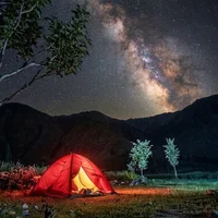
Camping at or near the summit is possible and popular for catching the sunrise, but it can be very windy. Most campers pitch their tents in the flatter meadows just below the final peak.
What is the condition of the trail markers?
The main trail is relatively well-defined by foot traffic, but formal signage and markers are sparse. It is advisable to stick to the established path and avoid wandering off into the thick meadows, especially during foggy conditions.
When is the best weather window for a winter trek?
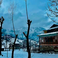
For those seeking a snow experience, the window from late December to February is best, though the final ascent becomes very slippery. Summer expeditions from May to August offer the most stable conditions with clear visibility of the surrounding Pir Panjal range.
Is mobile signal available at the top?
Surprisingly, mobile signals from various networks are often available at the summit due to the line-of-sight to nearby towns. However, the connection can be patchy and should not be fully relied upon for emergencies.
What level of physical fitness is expected for this hike?
A moderate level of cardiovascular fitness is required as the trail involves a consistent uphill climb. While not technically difficult, the thinning air near 3,000 meters can make the trek feel more strenuous for those not used to physical activity.
Weather
Location
You might also like…
Similar attractions in Bagh
Reviews
No reviews yet. Be the first to share your experience!